Turn Vehicle Data Into Transportation Visibility
Geotab provides real-time vehicle location, driver behavior, and fleet performance data. FTM connects that data to carrier records, load records, dispatch workflows, and transportation reporting inside Salesforce.
Geotab Knows Where. FTM Knows What It Means.
Geotab tells you where every vehicle is and how it is performing. FTM connects that information to the load it belongs to, the carrier managing it, and the customer waiting for it.
Telematics data on its own tells you where vehicles are. FTM connects vehicle location, driver status, and fleet performance to the operational and customer context that makes that data useful for decisions.
The location update is a starting point. The load record, carrier record, and customer record are where it becomes operational intelligence.
What Geotab Provides. What FTM Adds.
Geotab and FTM each solve a distinct part of the transportation operations picture. Together they close the gap between fleet visibility and business visibility.
Example Geotab Workflow Inside FTM
A compact view of how vehicle data connects to FTM transportation records, dispatch workflows, customer visibility, and reporting.
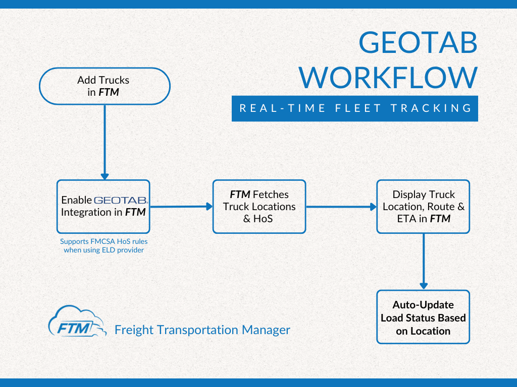
Example workflow only. Actual implementation depends on your Geotab setup, carrier model, workflows, and Salesforce environment.
What This Enables
Connecting Geotab data to FTM’s Salesforce-native transportation record produces outcomes that neither platform creates on its own.
Geofencing And Operational Automation
When a vehicle enters or exits a defined location, Geotab generates an event. FTM can connect those events to transportation workflows, customer visibility updates, and operational reporting automatically.
Vehicle location data becomes more valuable when it drives action. FTM helps transportation teams use Geotab location events to automate dispatch workflows, customer communication, reporting, and transportation operations without manual intervention at each step.
Real-Time Visibility For Customers
Geotab knows where the vehicle is. FTM connects that position to the shipment record and surfaces it to the customer who is waiting for delivery.
Before FTM connects Geotab data to the Customer Portal, a customer who wants to know where their shipment is calls dispatch. A dispatcher looks at Geotab, reads a position, translates it into an ETA, and calls or emails back.
With Geotab connected to FTM, the Customer Portal can reflect actual vehicle position automatically. The customer sees shipment progress. The dispatcher is not interrupted.
Customers with large shipping volumes can see multiple shipments at once, each with live status driven by the same Geotab data the fleet team already has.
One Salesforce Record, Multiple Data Sources
Geotab data does not sit in a separate fleet management dashboard. FTM connects it to the same Salesforce record used by dispatch, finance, and leadership.
A load record in FTM is not just a shipment entry. It is the point where vehicle telemetry, driver status, customer expectations, carrier relationships, and financial records converge in one place.
Geotab knows what the vehicle is doing. FTM connects that to everything the business needs to know about the load it is carrying.
What This Actually Changes For Your Team
Visibility Beyond Telematics Access
Geotab is valuable when telematics access is available. But many brokers and shippers move freight through carriers who manage their own ELD and telematics systems independently.
Both paths return location data to the same Dispatch Console. The choice of method depends on which carriers are on which loads, not on a fixed integration requirement.
Questions teams ask before connecting Geotab.
For questions specific to your fleet configuration, a transportation specialist can walk through your use case.
See how Geotab and FTM work together.
Bring your current fleet visibility setup. We will show how vehicle location and fleet data connects to load records, dispatch, customer visibility, and reporting inside FTM.
